
Trace a Lomita Street Address
A Lomita by-address search works best as a parcel walk, not as a promise of a complete household roll. Start with the city's Street & Parcel Map to see the street pattern and the lots fronting or sitting behind it. Move to the county Assessor Portal for a parcel identifier and map context. Ask for a specific owner only after the parcel is clear, then carry that name and a likely year to the county recorder. City files and dated directory volumes add evidence about projects, subscribers, and listed occupants.
Each step answers a different question. A map shows geometry. An assessor result shows land and assessment information. A deed shows indexed parties and a legal description. A permit file shows an applicant, contractor, inspection, or project date. A cross-cross volume shows what was listed at a house in a particular edition. Keeping those roles separate is what makes an address trail useful for property history, family research, and neighborhood curiosity.
- Open Lomita's Street & Parcel Map and mark the target lot, nearby parcels, cross streets, and any lot that sits behind the street frontage.
- Search the Los Angeles County Assessor Portal by address or parcel identifier. Record the AIN, situs, legal-description clues, map position, and effective date.
- Request the owner for that specific parcel through the Assessor's phone, counter, or contact route. Do not treat the public portal as an online owner-name list.
- Take the owner name and likely acquisition year to the RR/CC grantor-grantee index in Norwalk. Search the current owner as grantee, then the earlier seller as grantee in prior years.
- Search Lomita City Clerk and Building & Safety files by address, project title, developer, or action date. GeoCivix can track permits, plans, revisions, issuance, and inspection requests, but its public historical fields were not fully verified.
- Compare the exact street and number in Haines or Pacific Bell volumes. The broader collections and their gaps sit with the Lomita city directory collections, not in a modern parcel portal.
- If the question shifts from a street to one person, use the Lomita resident lookup path and keep the address record as one dated anchor rather than a whole-block conclusion.
Read the Lomita Assessor Portal
The Assessor Portal is the key address tool in a Lomita parcel workflow. Its public search starts with Basic Search, then offers an AIN or Address mode, a Legal Search mode, and Map Search. A situs address can be entered through autocomplete, or a known ten-digit AIN can go straight to the parcel. The result can show the land identity, legal-description clues, characteristics, values, transfer clues, and map position. The online interface does not advertise a general owner-name search.
The Assessor sample parcel capture in the street-directory manifest shows why a parcel page is a research anchor, not a complete resident list.
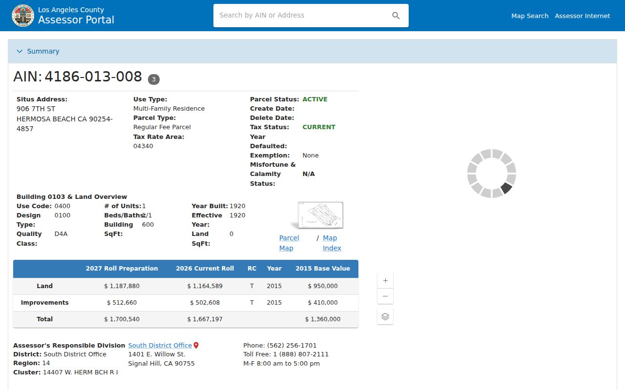
Owner information is available for a specific parcel through the Assessor by phone, office, or contact form. Bulk data is a Property Data Sales product. If an address fails, try cross streets and Map Search. Multi-unit, commercial, corner, and new-development parcels can need that extra orientation before the AIN is clear.
| Portal mode | Input or control | Lomita use |
|---|---|---|
| Basic Search | Tab | Primary public entry point for a parcel search. |
| Search by AIN or Address | Autocomplete text, required | Accepts a ten-digit AIN or situs address. |
| Legal Search | Tab | Uses a legal-description path; dynamic subfields were not fully captured. |
| Map Search | Tab or link | Browses mapped parcels and helps resolve a corner or cross-street question. |
Save the AIN, map position, situs label, legal description, and effective date together. That small record card keeps one parcel from being confused with a nearby lot when the street has multiple units or an older address form.
Map the Lomita Parcel Pattern
Lomita's static Street & Parcel Map is useful for enumerating lots along a street, including parcels that sit behind a frontage parcel. It is a free PDF, not a clickable owner map. The county GIS-NET public viewer offers address, AIN, and intersection search, layer toggles, identify and query tools, buffer, draw, measure, export, report, and print controls. GIS-NET is designed for unincorporated territory, so it should be used at a municipal edge or for an unincorporated comparison, not treated as the universal Lomita viewer.
The Los Angeles County GIS-NET capture shows the layer-and-query style of the county map tool.
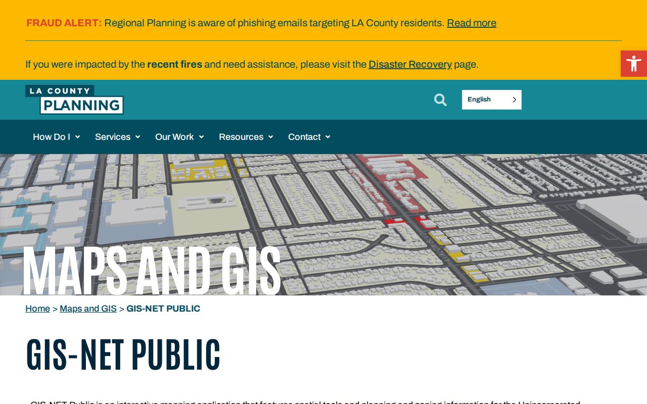
Use the city map to set the block geometry, then use Assessor Map Search to click the target parcel and nearby polygons. Record each AIN separately. A parcel across an alley or on a corner may be close on the map without sharing a boundary. This matters when the goal is a street-by-street record trail rather than a loose radius around a point.
Note: Lomita's city parcel map confirms geometry, while the Assessor supplies parcel evidence; neither map publishes a complete list of people at the address.
Lomita Street Directory Records by Address
Address-keyed records make a useful local index, but they do not all use the same key. The city map uses geometry. The Assessor uses address or AIN. The recorder uses indexed party name and recording year. City permits and planning files use address, project, or action clues. Historical cross-cross volumes use street and number. Voter information is not an open block list and must stay within its statutory access lane.
| Record set | Keeper | Address clue | Access and limit |
|---|---|---|---|
| Street & Parcel Map | City of Lomita | Street names, frontage, parcels behind a lot | Free static PDF; no owner links |
| Assessor parcel record | Los Angeles County Assessor | Situs address, AIN, map, legal description, characteristics | Free address or AIN search; owner is specific-parcel access |
| Tax bill and assessment | LA County Treasurer and Tax Collector | AIN, tax mailing, payment or delinquency information | Current portal; not proof of occupancy |
| Recorded instrument | Los Angeles County RR/CC | Owner name after assessor bridge, deed legal description | Norwalk name-and-year index; not address or APN indexed |
| Permit and planning file | Lomita City Clerk, Building & Safety, Planning | Address, applicant, contractor, project, action, inspection | GeoCivix, counter, or focused request; historical fields vary |
| Cross-cross directory | LA County Library Californiana | Street and number, listed subscriber or occupant | Selected 1981-2009 editions in closed stacks |
| Voter file | California election officials | Registration address only in an authorized extract | Purpose-restricted; not public street browsing |
The chain is address → AIN → specific owner request → grantor or grantee index → legal description → dated city or directory evidence. A tax mailing address can differ from the situs. A permit applicant can differ from the owner. A cross-cross subscriber can differ from both. The address trail stays accurate when each row says what the source actually showed.
Separate Lomita Situs and Mailing Keys
Three address words do different work in a Lomita search. The situs is the land location. The assessment or tax mailing address is where the owner asked correspondence to go. The legal description is the lot, block, tract, or other land description that can survive a postal change. A parcel search should not collapse those keys into one claim about a person.
The Los Angeles County Treasurer and Tax Collector portal is useful for the tax side of the comparison. It can show current bill, payment, or delinquency information keyed to the AIN, but tax data does not prove who occupies the situs. An out-of-area mailing address may suggest an absentee owner, but it is not proof of where anyone lives.
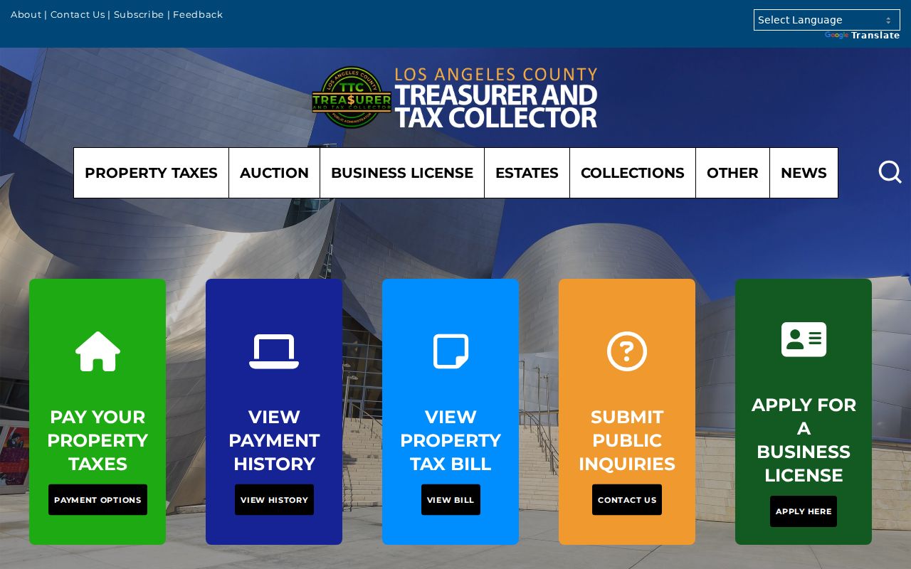
The tax-portal capture gives the mailing and assessment side of an address trail. Pair it with the Assessor parcel, then use the legal description when the street label, unit, or postal city has changed.
- Parcel
- A defined unit of land identified in assessment and mapping records; neighboring parcels can share a street frontage.
- Situs address
- The physical location assigned to the land or improvement, which may differ from a tax mailing address.
- Legal description
- Lot, block, tract, or another land description used in recorded instruments and useful across address changes.
- Plat
- A recorded or mapped drawing that lays out lots, blocks, streets, or easements.
- Criss-cross directory
- An address-first directory section that moves from street and number to the listed subscriber or occupant.
Build a Lomita Deed Trail
The recorder step begins only after the address has become a parcel and a specific owner request has supplied a name. Los Angeles County RR/CC real-estate records are indexed by grantor or grantee and recording year. They are not searched by street address or APN. The county's request page describes records reaching back to 1850, while the local archive table uses 1851 as the verified working boundary. The name-and-year index is viewed in Norwalk, with 1851 to 1957 on the lower level and 1958 to the present on the second floor.
Start with the current owner as grantee in a likely acquisition year. Pull the acquisition instrument, then carry its grantor, document reference, and legal description to an earlier year. Search that grantor as a grantee. The process is address → AIN → specific owner → deed party → prior legal description. The legal description helps when a street name, unit, or postal line does not match the older record.
Access has several channels. RR/CC-linked LexisNexis accepts online copy orders. Mail goes to the Real Estate Records Section, P.O. Box 1130, Norwalk, California 90651-1130. Room 2207 handles in-person viewing. Online orders are processed within 20 working days, and full documents are purchased. Telephone index searches are not accepted. The RR/CC indexing warning is the key reminder that a street or APN cannot replace the name-and-year bridge.
Note: Search the recorder after the assessor bridge; an address typed into the RR/CC index will not produce a complete deed trail.
Browse Lomita Cross-Cross Volumes
A cross-cross directory is the historical address layer of a Lomita by-address resource. The Haines Los Angeles South Suburban run lists 1981, 1983 through 1986, and 1988. The Los Angeles County South Coast run lists 1989, 1990, and 1992. Pacific Bell's South Bay Address and Phone volumes list June 1988 and December 1990, 1991, and 1992. The South Bay YP/WP editions include 2001-02, 2003, 2004-05, 2005, 2006, 2008, and 2009.
The LA County Library Californiana Collection holds those runs in closed stacks at Norwalk. Ask reference staff for the exact street, number, and edition. Do not fill an absent year by assumption. Record a listed subscriber, telephone, business, or occupant exactly as printed, then compare it with deed, assessor, permit, newspaper, or census evidence.
A listing is not a deed and is not a full household roster. A telephone subscriber can differ from a property owner. A business listing can use a storefront or mailing location. A missing number can reflect a directory gap, a move, a changed address, or a format choice. The date and the volume title are part of the result.
Use Lomita Permits as Address Evidence
Lomita's municipal files can add a dated project trail to an address search. The Building & Safety Division says the city now supplies plan check, permits, and inspections, and that records formerly held by Los Angeles County Building and Safety were transferred to Lomita. GeoCivix supports plan submission, fee payment, electronic comments, status tracking, revisions, permit issuance, and inspection requests.
Search or request by street address, project, developer, approximate agency date, or document title. The City Clerk's guidance recommends a street address or property location, developer name, and Council or Planning Commission action date as retrieval clues. The public historical GeoCivix fields and result screen were not fully verified, so an address directory should not promise a complete name browse from the portal.
Use the Building & Safety page for the municipal contact route: BuildingSafety@LomitaCity.com, 310-304-3788, and a counter open from 8 a.m. to noon and 2 to 4 p.m. Monday through Thursday and every other Friday. Older or missing material can move through the City Clerk public-records route by email, mail, or hand delivery.
Permit history dates construction, alteration, inspection, or an agency action. It does not prove that the applicant, contractor, owner, or person named in a file lived at the address. Keep the role and the date attached to the project record.
Read the Assessor Sales-Price Quirk
The Assessor Portal's “indicated sales price” is derived from documentary transfer tax. The portal's official example displays $450,004 after leading digit information is appended at the end. That value is not a typographical literal purchase price to repeat as fact. Use it as a transfer clue, then read the recorded deed or other official instrument for the transaction evidence.
The same portal can display “VAC/VIC,” meaning vacant in vicinity proximity. That label does not establish that the selected parcel is vacant. A corner parcel, multi-unit address, commercial site, or new development can also make a street search look incomplete until cross streets and Map Search resolve the land.
Portal reading tip. Treat an indicated sales price as a documentary-tax-derived clue and VAC/VIC as a proximity label. Confirm both against the parcel and recorded instrument.
Check Lomita ZIP and City Lines
Postal geography and municipal geography can split an address trail. ZIP 90717 is the principal Lomita postal ZIP, with the Lomita Post Office at 25131 Narbonne and facility identity 90717-9998. ZIP 90502 covers nearby Torrance and West Carson geography. A mailing city of Lomita does not by itself prove that a parcel sits inside incorporated Lomita.
The USPS ZIP Code Lookup offers “ZIP Code by Address,” “City and State,” and “Cities by ZIP Code.” Use the address mode to normalize a unit, city, state, and ZIP. Then check the city boundary or parcel map for jurisdiction, and use the Assessor for land identity. These tools answer delivery, municipal, and parcel questions separately.
The research's concrete edge example is 23206 Normandie in unincorporated West Carson. A county parcel list shows a Lomita mailing city and rows involving both 90717 and 90502, while surrounding parcels use Torrance 90502. If an address search crosses that edge, route permits, planning, elections, and property questions to the actual jurisdiction rather than the postal line.
Note: A ZIP can narrow an address search, but it cannot create a verified all-residents or all-owners list for Lomita.
Cross a Lomita Edge with Care
Lomita covers 1.91 square miles and had a 2020 population of 20,921. Its compact incorporated area adjoins Torrance, Los Angeles, Rolling Hills Estates, and Rancho Palos Verdes. The historical community footprint was larger than today's city, and earlier records can follow ranchos, subdivisions, and county jurisdiction rather than the modern boundary.
When an old address fails, bridge it with the surname, tract or legal description, cross streets, parcel map, newspapers, aerials, and the exact directory title. The city map can show whether a parcel lies within the municipal line. GIS-NET is designed for unincorporated territory and should not be used to silently relabel an incorporated Lomita parcel. The address record should state when a location is postal Lomita but legally elsewhere.
The same caution applies to historical place names. A directory entry that says Lomita may reflect the old seven-square-mile colony, a regional South Bay volume, or a current mailing label. Preserve the source's original geography before deciding that two addresses are the same place.
When a Lomita Street Directory Meets Privacy
A street directory cannot show a complete list of household members or every person associated with a parcel. DMV address data is restricted under the Driver's Privacy Protection Act. Utility and private delivery-customer lists are not public. An owner is not automatically an occupant, and a tax-mail recipient is not automatically a resident. Historical directories also omit people who were not listed or who fall in a missing edition.
My Voter Status authenticates an individual rather than publishing a block list. Registration-file use is limited by Elections Code §2194, and Government Code §7924.000 protects sensitive voter fields. Safe at Home can provide a substitute address and confidential voter registration for qualifying participants. A missing address is therefore not proof that a person has no local connection.
Lawful personal use. Lomita street and address records support family history, property research, reconnecting, and civic curiosity. Do not use a street directory or public-record trail to stalk, harass, intimidate, or harm anyone. California Penal Code §646.9 and related civil and criminal rules still apply.