
A Block View of Lomita Residents
Lomita neighbors show up in layers, not in a single public roster. The first layer is land: the Los Angeles County Assessor Map Search identifies a parcel, its Assessor Identification Number, boundaries, and map position. The city parcel map adds street geometry. A restricted voter extract can answer a different question only when a requester qualifies under California law. Neighborhood Watch supplies an organizing path, while council maps add civic context. Each source has a different custodian, date, and access rule, so the record trail should keep those roles separate.
| Source | What It Shows About a Block | Access |
|---|---|---|
| Los Angeles County Assessor Map Search | Adjacent parcel boundaries and AINs; owner information is handled one parcel at a time | Free address or AIN search; specific owner request by phone, counter, or contact route |
| City Street and Parcel Map | Street names, frontage, behind-lot geometry, and the parcel pattern | Free static PDF; no owner links |
| LA County GIS-NET | AIN, address, intersection, layer, identify, query, buffer, measure, and map-output tools | Free, but designed for unincorporated territory |
| Restricted voter file | Registered voters and addresses in an authorized extract | Qualifying purpose and application required |
| Neighborhood Watch and council maps | An organizing contact or civic district context, not a member directory | Public meeting or map access; no public household roster |
An owner record links a person to a parcel. It does not prove that person sleeps there, that every household member is known, or that the next parcel has the same ownership date. An occupant may be a subscriber in a directory, a family member, or another person whose name does not appear in the deed trail. A useful block lookup reports the role shown by each source instead of turning several partial clues into one invented list of Lomita neighbors.
Click Outward for Lomita Neighbors
A reproducible block search moves from one known address to the parcels that touch it. Preserve the starting address, the date of each lookup, and the source used at every step. That order prevents a mailing city from being mistaken for a city limit and prevents a tax record from being treated as a household count.
Address → postal check → city boundary → target AIN → adjacent AINs → specific owner requests → dated civic and historical checks
- Normalize the address. Run the street, unit when known, city, state, and ZIP through the USPS ZIP Code Lookup. Record the returned postal line, but treat it as delivery evidence rather than proof of municipal jurisdiction.
- Check the city boundary. Compare the postal result with Lomita boundary and parcel materials. A Lomita mailing line can reach nearby geography, so confirm whether the land is inside the incorporated city before choosing a city custodian.
- Find the target parcel. Search the Assessor Portal by address. If the address fails, try cross streets and the map view, then use the city parcel map to narrow the likely lot and obtain the ten-digit AIN.
- Record the surrounding geometry. Save the target AIN and legal description. On the parcel map, note the AINs immediately left and right and the parcels sharing the rear lot line. A parcel across an alley or around a corner may be nearby without sharing an edge.
- Open each adjacent parcel separately. Repeat the AIN or address lookup for every adjoining parcel. The online portal does not publish an owner-name block list, so request ownership for a specific parcel through the assessor phone, office, or specific-property contact route.
- Label ownership carefully. Compare the situs address with any tax mailing address that is lawfully supplied. An out-of-area mailing address can suggest absentee ownership, but it does not prove who occupies the parcel or identify every nearby household.
- Add a historical layer only when needed. For an older block, choose the exact Haines cross-cross volume and browse the street and house-number sequence. Record vacancies, businesses, multiple listings, and missing numbers as they appear. Do not fill a gap between the listed years by assumption.
- Date the result. For construction or activity, request address-specific permit, planning, code, or project files through the Lomita Building and Safety page, City Hall counter, or a focused CPRA request. A contractor or permit applicant can differ from the owner or occupant. Keep each dated snapshot separate.
When the question expands from an immediate block to every parcel on one named street, use the Lomita street directory workflow. The block method should stay focused on the surrounding radius and its distinct parcel, civic, and privacy limits.
Check Lomita Parcel Geometry
The Lomita city maps collection includes a Street Map and a Street and Parcel Map. The parcel PDF is useful for seeing which lots front a road and which sit behind another frontage lot. It is a static map, not a clickable owner database. Use it to count the land units that need separate assessor checks, not to assign names to shapes.
Geometry matters on a compact block. A rear parcel can be hidden from the street number that first caught attention. A corner lot can touch two roads, and a parcel across an alley can feel close while belonging to another edge. Compare the street names, parcel outlines, cross streets, and legal description before calling a person a neighbor. The map also helps when an address search returns more than one possible parcel or a new development does not match an older directory.
Note: A city parcel map can settle block geometry, but it cannot turn a lot outline into a named household.
GIS-NET and Lomita Neighbors
GIS-NET adds tools that a simple parcel page may not: AIN, address, or intersection searches; layer switches; identify and query functions; buffer, draw, and measure tools; and export, report, and print options. Those tools can help inspect an unincorporated edge or test a spatial relationship. GIS-NET is designed for unincorporated territory, however, so it is not a universal Lomita parcel viewer.
For an incorporated Lomita parcel, start with the Assessor Map Search and the city street and parcel map. At a municipal edge, GIS-NET can supply planning context for land outside the city, but it does not override the boundary or replace the custodian for a Lomita address. A map layer is evidence about geography. It is not evidence that a person occupies every displayed parcel.
- AIN
- The Assessor Identification Number, a ten-digit parcel key used to connect an address with assessment and map records.
- Situs address
- The physical address assigned to the land. It can differ from the address used for tax mail.
- Parcel
- A mapped unit of land with its own legal identity, even when one building or street view makes several lots look like one property.
- Buffer
- A selected distance or area around a mapped point or feature. It describes space, not a verified list of people.
Lomita Voter Data Is Not a Block List
California’s My Voter Status tool authenticates one person. It asks for identity-matching details such as first name, last name, date of birth, and, where applicable, a California driver license or identification number or the last four digits of a Social Security number. It can return registration status, party preference, vote-by-mail status, polling or vote-center information, and election details. It does not reveal ballot choices and does not let someone browse every registered voter on a Lomita street.
A voter-file request is a separate channel. Elections Code section 2194 limits disclosure to election, scholarly, journalistic, political, or governmental purposes. An application identifies the requester or organization, geographic scope, data sought, intended purpose, responsible person, delivery choice, and certification under penalty of perjury. Sensitive fields are protected under California voter-information rules and Government Code section 7924.000. A county subset may be requested through the RR/CC at 12400 Imperial Highway, Norwalk, 800-815-2666, using the documented application route.
Myth check. An authenticated voter status result is a personal verification, not a public block directory. A qualifying file request still cannot be treated as permission to publish a roster of Lomita neighbors.
Lomita Residents: Owners vs Occupants
The assessor’s parcel record is strongest for land identity and current assessment clues. Owner information is intentionally withheld from the public online page and can be supplied for a specific AIN or address through a phone, office, or contact request. That access path answers who is associated with the parcel in the assessment record. It does not create a list of people who live in the building.
Keep the address types apart. The situs is the land location. A tax mailing address is where correspondence is sent and may be elsewhere. A cross-cross directory records a listed subscriber or occupant at a particular date. A permit file may name an applicant, contractor, or project contact. None of those labels should be silently changed to resident. When two sources disagree, preserve both dates and roles, then ask the responsible office for the record that controls its own field.
Note: A mailing address outside Lomita can suggest absentee ownership, but it never proves who lives at the situs.
USPS Lines Can Mislead Lomita Residents
USPS provides three useful modes: ZIP Code by Address, City and State, and Cities by ZIP Code. Enter the street, optional unit, city, state, and known ZIP, then compare the returned delivery line with the land record. This is the right way to normalize a neighbor’s address for mail, but a ZIP is delivery geography rather than a city charter boundary.
The county Green Zones parcel list shows why the distinction matters near Lomita. One West Carson address at 23206 Normandie appears with a Lomita mailing city and rows involving both 90717 and 90502, while the parcel sits outside incorporated Lomita. The address therefore needs three checks: USPS for routing, a city boundary or General Plan map for jurisdiction, and the Assessor AIN and legal description for the land. Do not send a record request to a city merely because the postal line says Lomita.
Note: A postal city can guide address normalization, while the municipal boundary determines which Lomita office holds a local record.
Lomita Neighborhood Watch Contact
Lomita Neighborhood Watch is an organizing channel, not a public member directory. The program requires at least six neighbors to organize a group. Attendance and contact run through the Public Safety and Traffic Commission, which meets on the third Wednesday at 6 p.m. at City Hall. City coordination is available at 310-325-7110, extension 141.
| Contact layer | What it provides |
|---|---|
| Neighborhood Watch threshold | At least six neighbors can form an organizing group; the program does not publish a roster. |
| Public Safety and Traffic Commission | Third Wednesday meeting, 6 p.m., at City Hall; a public civic route for coordination. |
| City coordination | 310-325-7110 x141 for the program’s organizing contact, not a list of member names. |
No official neighborhood-association directory was found for Lomita. That absence is useful to state plainly. A community contact can help residents organize a meeting or safety discussion, but it cannot be used to obtain private member names or turn attendance into a resident roll. Separate public-safety portals, such as the LASD Inmate Information Center and the CDCR incarcerated-person locator, report custody information rather than a neighborhood roster; treat both as distinct record systems with their own limits.
Lomita Residents in Five 2023 Districts
Lomita’s 2023 districting process supplied five civic districts and archived map submissions as public records. Those districts add context for council representation, public meetings, and the civic location of a block. They are not neighborhood names, association boundaries, or evidence that every household in a district shares a contact list.
Use a district map to understand which civic channel may hear a concern, then return to parcel and address records for land questions. A district label should stay tied to the 2023 context that produced it. It should not be used as a shortcut for identifying current block residents or for inferring who attends a meeting.
Lomita Residents Across Older Records
Historical block work uses exact editions, not a smooth annual roll. The LA County Library Californiana Collection lists Haines cross-cross volumes for 1981, 1983-1986, 1988-1990, and 1992. Pacific Bell South Bay address and phone volumes cover June 1988 and December 1990-1992. South Bay YP/WP editions appear for selected years from 2001 through 2009. These closed-stack materials are dated address snapshots, not a live directory of Lomita neighbors.
The Californiana Collection is at Norwalk Library, where staff reference service should be contacted before travel. Compare a listed street number with the city parcel map, then use deeds, census material, newspapers, or permits to bridge a gap. Lomita’s older community footprint also differed from the modern incorporated city, so a historical Lomita reference may need a boundary check before it is matched to today’s parcel.
Note: Missing directory years are gaps in evidence, not permission to assume that the same household remained at the address.
Lomita Records: Official vs Compiled Data
Compiled commercial neighbor tools combine deeds, assessment data, directory material, and other datasets into a convenient result. The category can be stale, merge former owners with relatives or occupants, omit protected people, and lag a recorded transfer. Official work is slower, but each row can retain the custodian, date, geography, and role that gave the name meaning.
| Question | Official layers | Compiled tools |
|---|---|---|
| What is the source date? | Parcel, deed, voter, map, permit, or directory date can be recorded separately | Multiple source dates may be hidden behind one current-looking result |
| What role does a name have? | Owner, subscriber, voter, applicant, or civic contact stays labeled | Household grouping may blur owner, occupant, relative, or former resident |
| Where is the boundary? | AIN, legal description, city line, and postal line can be compared | Postal or inferred location may be treated as the same thing as city jurisdiction |
| How should a result be used? | Verify a specific fact with the custodian and preserve uncertainty | Use only as an unverified lead, never as proof of a current neighbor |
For a careful Lomita block lookup, keep official records in separate dated rows. A disagreement is a finding to explain, not a missing field to fill with a guess. The same discipline protects family-history work, civic questions, and ordinary efforts to understand a nearby parcel.
Privacy Boundaries for Lomita Residents
Public parcel and map records do not supply a complete household roster. Other occupants may not appear in ownership records. Household members, DMV addresses, utility customers, delivery customers, and protected voters are not open block fields. California’s Safe at Home program uses a substitute address and confidential voter registration for qualifying participants, with limited protections for certain recorded addresses. A missing name can reflect privacy, timing, or source limits rather than absence from the block.
California public records may not simply be masked or removed on request without a legal basis or court authority. The proper response to a protected address is to stop looking for a workaround and use the custodian’s published process. The Safe at Home program explains the substitute-address route. California’s stalking law, Penal Code section 646.9, civil-harassment process under Code of Civil Procedure section 527.6, and voter-data limits set clear boundaries for personal research.
California Megan’s Law is a separate statutory public-safety search, not a general directory of Lomita neighbors. The California Megan’s Law search offers name, geographic, address, and map modes, but the public display can show a full address, ZIP only, or no address depending on the record.
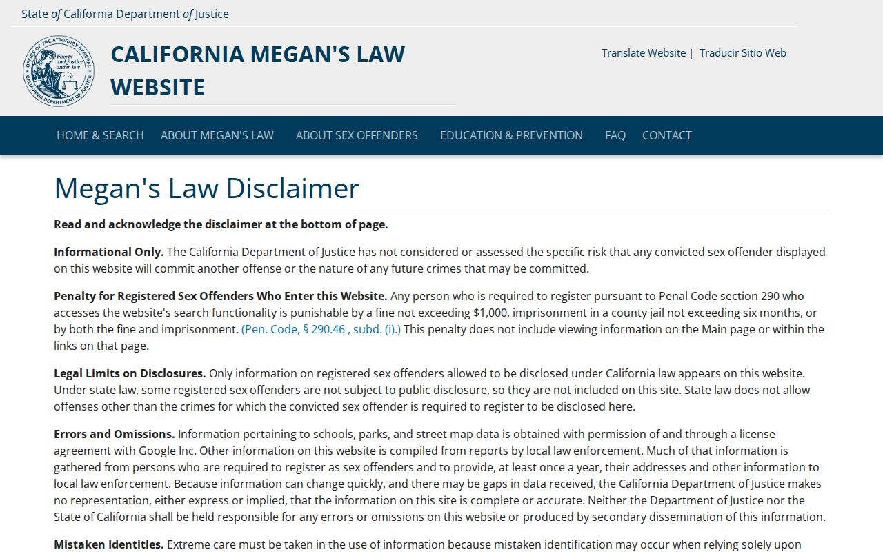
The California Megan’s Law image shows why a public safety result must be read within its statutory scope. An omitted address or absent result is not proof that a person is absent from every registry, and any lookup must follow the displayed anti-harassment limits.
Lawful use. Use Lomita parcel, map, and civic records for personal, lawful research, family reconnection, neighborhood awareness, or safety planning. Never use a record to watch, intimidate, harass, stalk, or harm another person.